Cairo International Airport (CAI)
Driving Directions and Car Hire / Rental
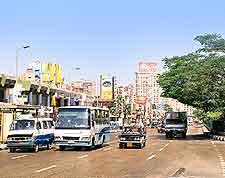
(Cairo, Egypt)
The roadways connecting Cairo International Airport (CAI) and the city centre are clearly marked. As you depart from the city, follow Salah Salem Road to the 6th October Bridge. From this point, the road signs will point to Heliopolis, where you will find Cairo Airport.
On the southern side of Cairo Airport is the 03 King Khaled Motorway, which stretches in an east-west direction and joins the 06. To the north, the 04 Al-Fariq Aziz Al-Masry road leads into the heart of the city, together with the Al-Uruba, which is the main route to and from the airport, joining the Salah Salim and Al Abbassiyya roads along the way.
Cairo International Airport (KIR) Airport Car Rental / Car Hire
Several car hire companies and rental agencies are available at Cairo Airport. Agency counters can be found in the Arrivals area, and while rentals may be arranged on-the-spot, it is recommended that you pre-book in order to ensure that the vehicle you rent matches your preferences.
Heliopolis is located 22 km / 14 miles north-east of Cairo and offers road access to a wealth of Egyptian destinations and historical sites. Most notably, the pyramids at Giza are only 40 km / 25 miles away.
The car rental operators below can all be found at Cairo Airport:
- Avis
- Budget Car Rental
- Europcar
- J Car
- Hertz
- Thrifty
Cairo International Airport (CAI) Car Rental

